


Community Profile
The Cumberland Community Profile provides a demographic analysis based on results from Censuses of Population and Housing data.

Community Atlas
The Cumberland Community Atlas displays a collection of thematic maps based on the Census, an important tool for future planning and development.

Digital Inclusion Index
Connected digital technologies, particularly the internet is rapidly changing the way we live, learn,
and work. Learn more about the importance to track the social and geographic distribution of digital
inclusion across the community.

Economic ID
The Cumberland Economic ID - presents economic information that enables you to describe the area's role within the broader economy, explore options for economic development and promote the area's strengths.

Forecast ID
The Cumberland Forecast ID – forecasts what is driving population change in the community and how the population, age structure, and household types will change each year.
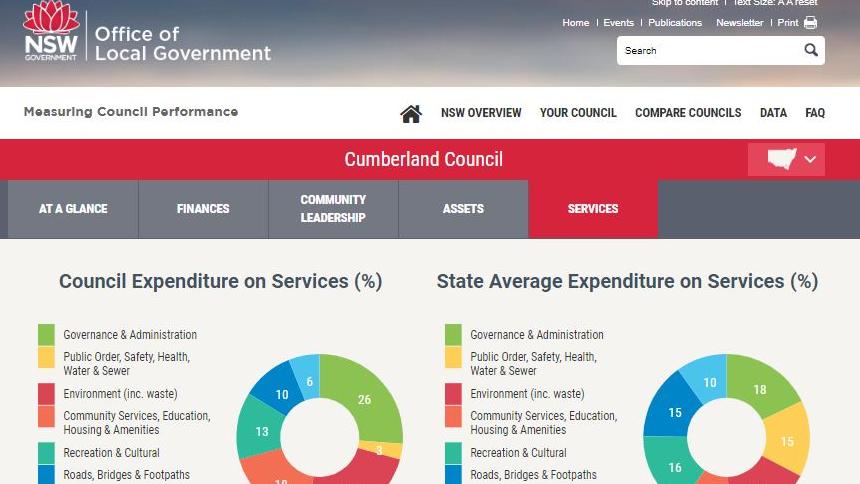
Measuring Council Performance
Keep up to date with Council's leadership profile, expenditure figures, asset allocation, community data and comparable statistics. This information is available through the NSW Office of Local Government.

Religious groups in Cumberland City
Discover the top 5 religious groups within Cumberland City.