


In 1788, Lieutenant William Badley R. N explored further the Parramatta and Prospect area, is then when they named Prospect Hill. From here he planned the new settlement.
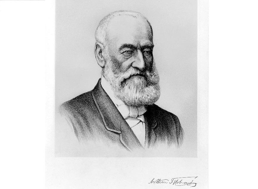
The City of Holroyd was created on 5 July 1872 and was originally known as the Municipality of Prospect and Sherwood. The name was changed to Holroyd on 11 January 1927 in honour of Arthur Todd Holroyd, the first Mayor of the Municipality. Holroyd became a City on 1 January 1991.
The first Council meeting was held at the residence of Richard Harper, J.P., at Church Street Parramatta on Tuesday 3 September 1872 for the purposes of electing a Mayor. Council meetings were then held at Mr Whitworth’s Cottage in Western Road (now Great Western Highway), Mays Hill. The first purpose-built Chambers was built on land at the corner of Burnett Street and Western Road, Mays Hill.
When Merrylands Railway Station was built in 1878 and Guildford Railway Station in 1876, people began to buy land and subdivide it for housing and small farms. This contributed to the 1880’s land boom.
In 1881, first subdivision for a Temperance Township called ‘Gough Town’ released at Merrylands on part of the former Church & School Lands to enable development in the area.
In 1882, Dog Trap was renamed Woodville Road, after the Woodville Estate located on the corner of Guildford Road owned by Sir John Lackey (1830-1903). Lackey Street in Merrylands is named after him. It was originally called ‘Dog Trap’ because dingoes still roamed around its vicinity in the early-mid 19th Century and the early settlers would go on trapping expeditions to kill them.
Wentworthville Railway Station was opened in 1885 and this increased the sale of land as people moved out of the City. In 1886 the population of the Municipality was 1,000 people.
Businesses were dragged in the area, industries such as the Junction Brick and Pottery Co. Ltd established on a 31-acre site owned by Andrew Sutherland Low beside the railway at Granville, this was to become The Holroyd Gardens in 1988.
In 1888-89, Henry Whitaker’s Estate was subdivided forming what we now know as Guildford. Further subdivisions were released in subsequent years, the main development was produced when the railway was extended, and Guildford Railway line showed appealing options for newcomers. The west side of Holroyd was primarily used as farming, particularly poultry farms settled here.
George McCredie purchased a big portion of the Whitaker’s Estate and built Linwood House in Byron Road. He became Mayor of Prospect and Sherwood from 1892 to 1995 and his son Ludovic followed in his steps also becoming Mayor from 1912 to 1914. Today Linwood House is heritage listed.
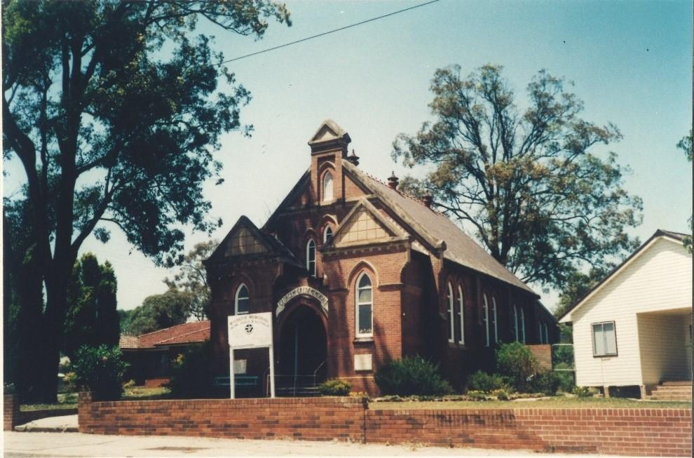
In 1905, McCredie Memorial Presbyterian Church was erected on the corner of Guildford and Byron Roads. Following George McCredie’s sudden death in 1903 his widow, Susan, donated money for the construction of this Church. Susan McCredie also donated 10 acres of land behind ‘Linwood’ to Prospect & Sherwood Council to be dedicated as McCredie Park.
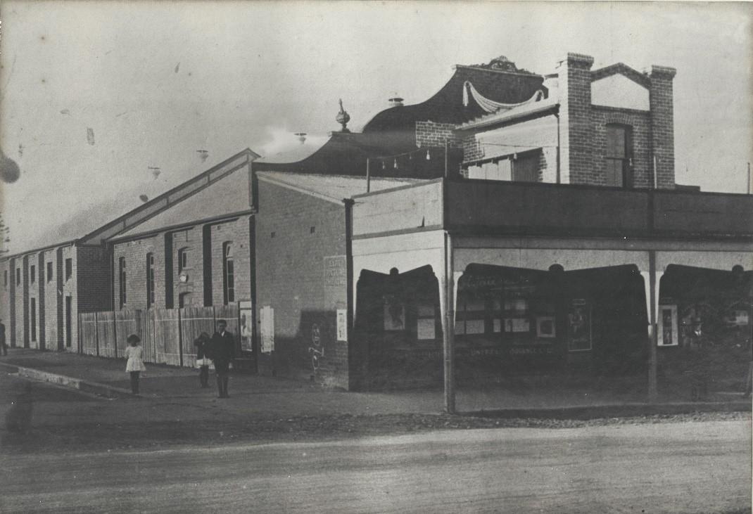
In 1913, the Elite Hall opened at Guildford. The Hall was later converted into the Guildford Regent Cinema which closed in 1967. The building is now used as the Guildford Community Centre.
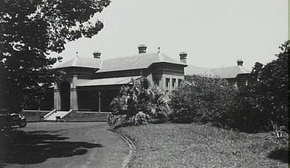
In 1915, Prospect & Sherwood Council’s second Council Chambers and Town Hall were officially opened by Local Member of Parliament, J.T. Lang, who later became Premier of NSW. Designed by architect, Donald Esplin (1874-1960), the building still stands at the corner of Arcadia and Arthur Streets, Merrylands West.
At the 1921 Census, the population of the area was 8,737 people. By 1933 the population had nearly doubled to 15,914 and the area was described as ‘partly metropolitan’, highlighting the areas farming and quarry interests.
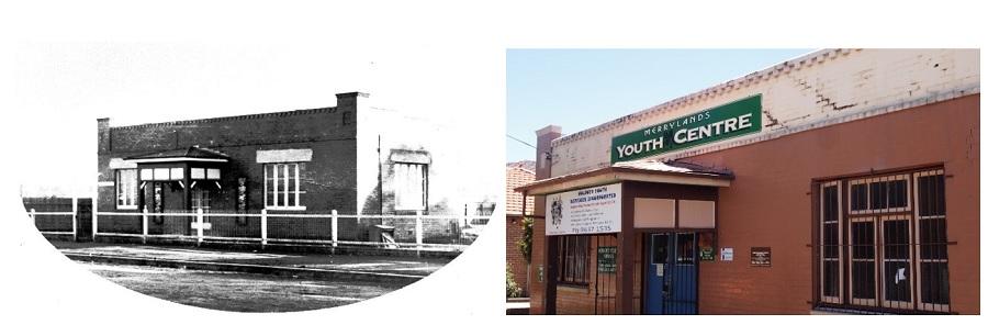
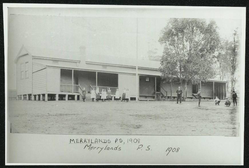
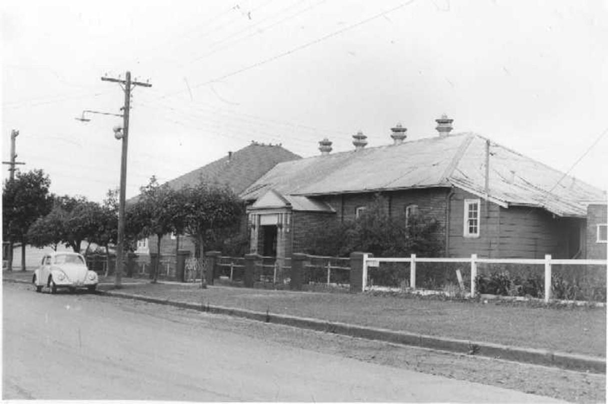
In 1921, Merrylands School of Arts opened on Merrylands Road near Treves Street and has since become Merrylands Youth Centre.
In 1923, big industries moved in the area and one of those was Bonds Factory that operated in Wentworthville (Pendle Hill). The factory closed in 2010.
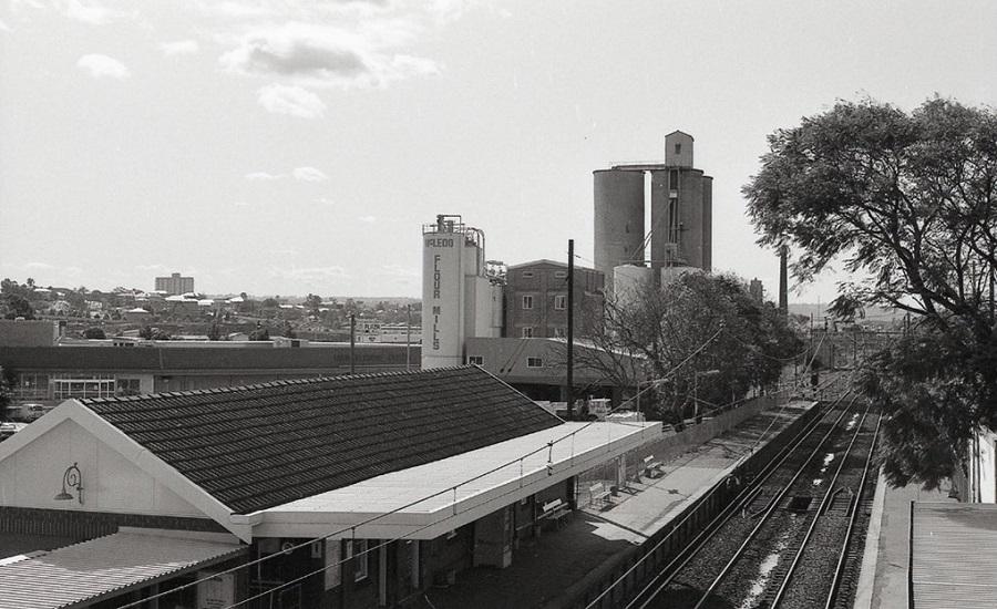
In 1926, the iconic McLeod’s Flour Mills started operation at Merrylands in Terminal Place beside the railway station. It suffered a mayor fire and was subsequently demolished
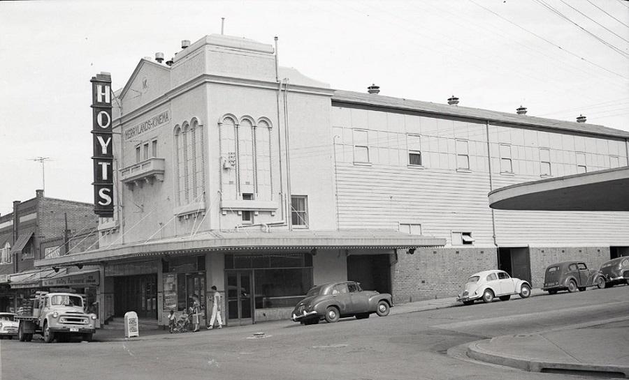
In 1928, Merrylands Kinema opened on the corner of Merrylands Road and Chertsey Street (Memorial Avenue). The grand building with Spanish Mission style façade was demolished in 1960 and replaced with shops.
Around 1929, 14 brick and tile works were in existence in the Merrylands area. In addition to Goodlet & Smith and Walker Benson, there were also the Newman-Underwood Tile Company in Newman Street (now King Park); Lazer’s in Betts Road; Tucknotts Tiles in Paton Street; and Ferguson Bros in McFarlane Street (now the Stockland Merrylands Mall site).
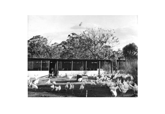
During the Great Depression of 1930s, Merrylands RSL sub-branch formed. Greystanes area was called the ‘Little Malta’ by Sydney Sun Newspaper, due to the influx of Maltese migrants who had settled in the area since 1910, and taken up poultry farming or market gardening. By 1932, 30% of the produce sold at the Sydney fruit and vegetable markets was supplied by Maltese market gardeners. Baiada Poultry and Cordina Farms are two of the biggest commercial success stories to emerge from the local Maltese community.
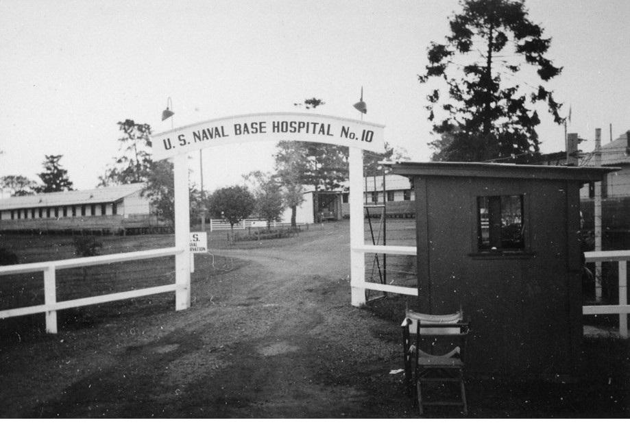
In 1942, Granville Park resumed by the Australian Government for use as a US Naval Base Hospital. After the War, the temporary hospital buildings were then re-used as emergency housing by the NSW Housing Commission to help combat a severe housing shortage in Sydney. Greystanes House and Sherwood Scrubs were also resumed for military use during World War II (WWII). Granville Park became home of the Eric Tweedale Stadium under Cumberland City Council in 2021.
By 1946, the Municipality boasted 225 shops, eight post offices, three banks, nine schools, four real estate agents, only one solicitor and three picture theatres. There was 227km of road in the area. Less than one third of these were sealed, over a third were gravelled with the remainder dirt roads.
The 1950s and 1960s saw intense road and drainage works in the area, improving the area considerably.
In 1953, a Commonwealth Scientific and Industrial Research Organisation (CSIRO) Sheep Biology Research Station was established at Prospect (now Pemulwuy) to support the wool industry. The research facility was renamed the Ian Clunies Ross Animal Research Laboratory following the CSIRO Chairman’s sudden death in 1959. The facility closed in 2002 and the land was sold in 2003 to be developed as the future suburb of Pemulwuy. Ian Clunies Ross Street which runs off the Great Western Highway was the original entry to the CSIRO Station.
In 1958-1959, the first industrial estate opened at Yennora attracting firms such as Comalco Pty Ltd, Moulded Products Pty Ltd, Stanton Pipes of Australia and Warrell Engineering to the area. This prompted Holroyd Council to zone more industrial areas on former rural lands at Yennora, Smithfield, Girraween, Woodpark and West Granville.
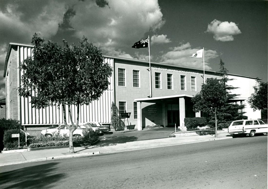
In 1962, the present Council Chambers was constructed in Memorial Avenue, Merrylands, formerly known as Chertsey Street. The Arcadia Street building was used by the Dunrossil Special School, Merrylands West.
In 1965, Wentworthville Memorial Swimming Centre opened. This swimming centre was upgraded in 2021. Only two years after the Wentworthville Swimming Centre opened, the Merrylands Swimming Centre also opened its doors.
During the 1970s, industries were stablished in Yennora transforming this as the industrial centre of Holroyd. One of those industries was the Sydney Wool Centre which was during its peak the largest facility of this kind in the world.
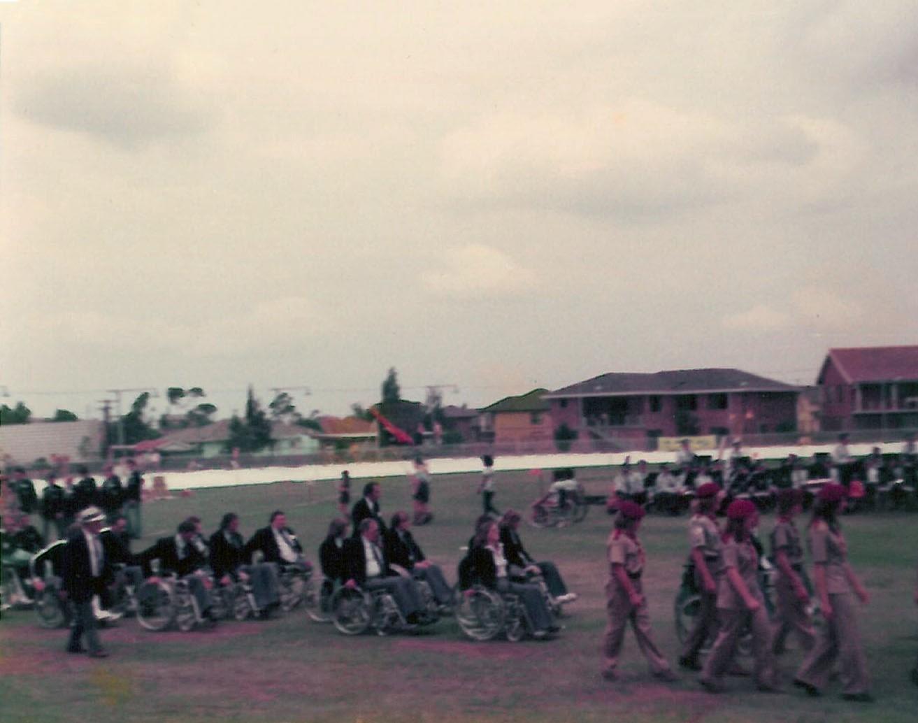
1972 marked the centenary of Holroyd Council and many sporting facilities such as Holroyd Sports Ground, Foray St Tennis Complex at Guildford West and Betts Road Sporting Complex in Greystanes were opened this year. Additionally, Stockland Merrylands Mall also opened. In this same year, Council also hosted the Seventh National Paraplegic and Quadriplegic Games at Merrylands attended by 130 competitors.
From 1984 to 1988, a section of the Cumberland Highway was developed between Old Windsor Road at Wentworthville and Warren Road, Smithfield via Freame Street, Emert Street, Jersey Road and Betts Road. This was intended to bypass Parramatta by replacing the existing Church Street/Woodville Road route to Liverpool. The Freame Street railway underpass opened in February 1986, followed by Emert Street to the Great Western Highway in November 1987 and Great Western Highway to Jersey Road in 1988.
In 1995, Sydney Murugan Hindu Temple opened on the Great Western Highway at Mays Hill. It was consecrated in 1999 and also included a Tamil Cultural and Educational Centre.
2004 - Pemulwuy, the youngest suburb in Holroyd was created in the former CSIRO and Boral lands.
2005 - The Warali Wali group of interpretive Indigenous artworks were erected beside Prospect Creek. Four stories are depicted by the artworks that interpret local flora and fauna. Warali Wali means possum in the Darug language, and the possum was a traditional totem of the Darug people.
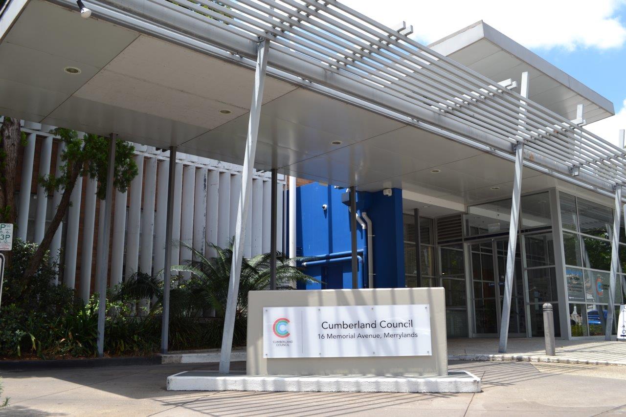
2016 - NSW Local Government amalgamations resulted in the creation of Cumberland Council in May. The new Council comprised the southern portion of Auburn Council, the Woodville Ward of Parramatta Council - Granville (south of the Western Railway Line) - and Holroyd Council excluding most of Mays Hill.
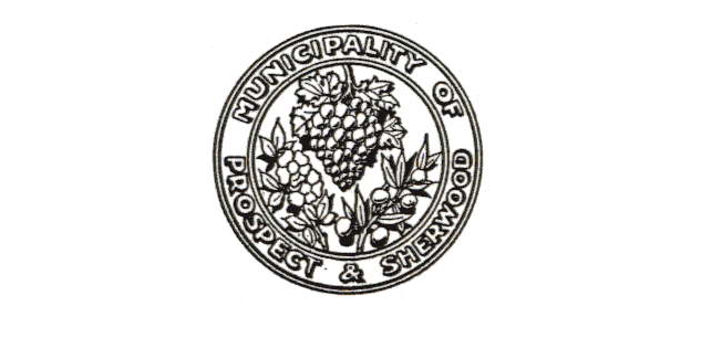
Seals, Crests and Logos
The seal of the Council of the Municipality of Prospect and Sherwood.
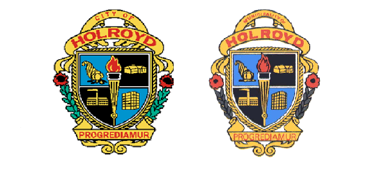
The crests of the Municipality of Holroyd and City of Holroyd incorporate the following symbols:
- The Cornucopia (horn with fruit and vegetables flowing out of it) represents the farming section of Holroyd.
- The Home represents the residential section of the community.
- The Factory represent the industrial section.
- The Office Building represents the business people within Holroyd.
- All of these are surrounded in a torch of programs.
- The Motto "Progrediamur" means "Let us go Forward".
- The decorative motif is the waratah and wattle (Australian wildflowers).
The crest of the City of Holroyd is reserved for official use concerning Mayoral Office and Councillor documentation and special occasions. In keeping with traditions it is reserved for formal use demanding an emphasis on distinction and being special.
It features in the Mayoral Chain of Office, used on special awards and certificates and situations which are of particular importance for Council and the community.
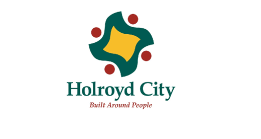
The starting point for the logo is a stylised map of Holroyd. The central motif provides a geographic reference to the City. The thick line around the stylised map is to reinforce the central shape and to symbolise an edge or border to the City.
The design of the Logo acknowledges a desire to identify Holroyd’s achievements and qualities and its distinct boundaries to the wider community of metropolitan Sydney and beyond. The four circles around the Holroyd shape symbolise people and the thick line around the map shape symbolises people holding hands in a circle.
The positioning line "Built Around People" symbolises the interplay between people – the Holroyd community and the place the physical shape of Council’s area of control.